Backpacking the Sawtooth High-Route
We’re days from the trailhead when we come upon Jim. “You guys see a solo hiker, guy about my age?”
“No, we’ve been off trail the last few days…” Elliot starts before Jim cuts him off.
“With the way his feet were killing him, he couldn’t follow me where I was going. We split four days ago with plans to meet down at the lake on the 10th or 11th. Today’s the 11th and we got a flight to catch”.
Elliot and I have barely seen anyone on the route we’ve taken, but we pull out the maps and trace the last three days for Jim’s benefit.

“The travel must be pretty smooth where you guys came from” Jim said, scanning us from running shoes up. “I see those shoes you’re wearing. I wouldn’t go far off trail without these boots.”
“I guess it all depends what you’re used to” I say.
We wish him luck, pocket our maps, and continue down the trail. Truth is, the travel HAS been pretty smooth. To our surprise we’ve moved steadily through the long glacial valleys flanked by rock walls, the giant fields of talus and scree, the portals of high windswept passes. Without the benefit of Jim’s experience, we didn’t know what to expect as we plotted our adventure on laptop screens and printed maps in Portland. We didn’t carry any delusions of smooth travel.
We went to the Sawtooths to explore a new range in high-route style. The concept is simple. Pick a mountain range and traverse its length, staying as close to the crest as possible while keeping technical difficulty to a grade manageable in trail running shoes. The appeal is aesthetic and athletic. I LOVE placing myself deep in these big mountain environments. I love finding presence in movement. I love throwing myself at big challenges with uncertain outcomes.
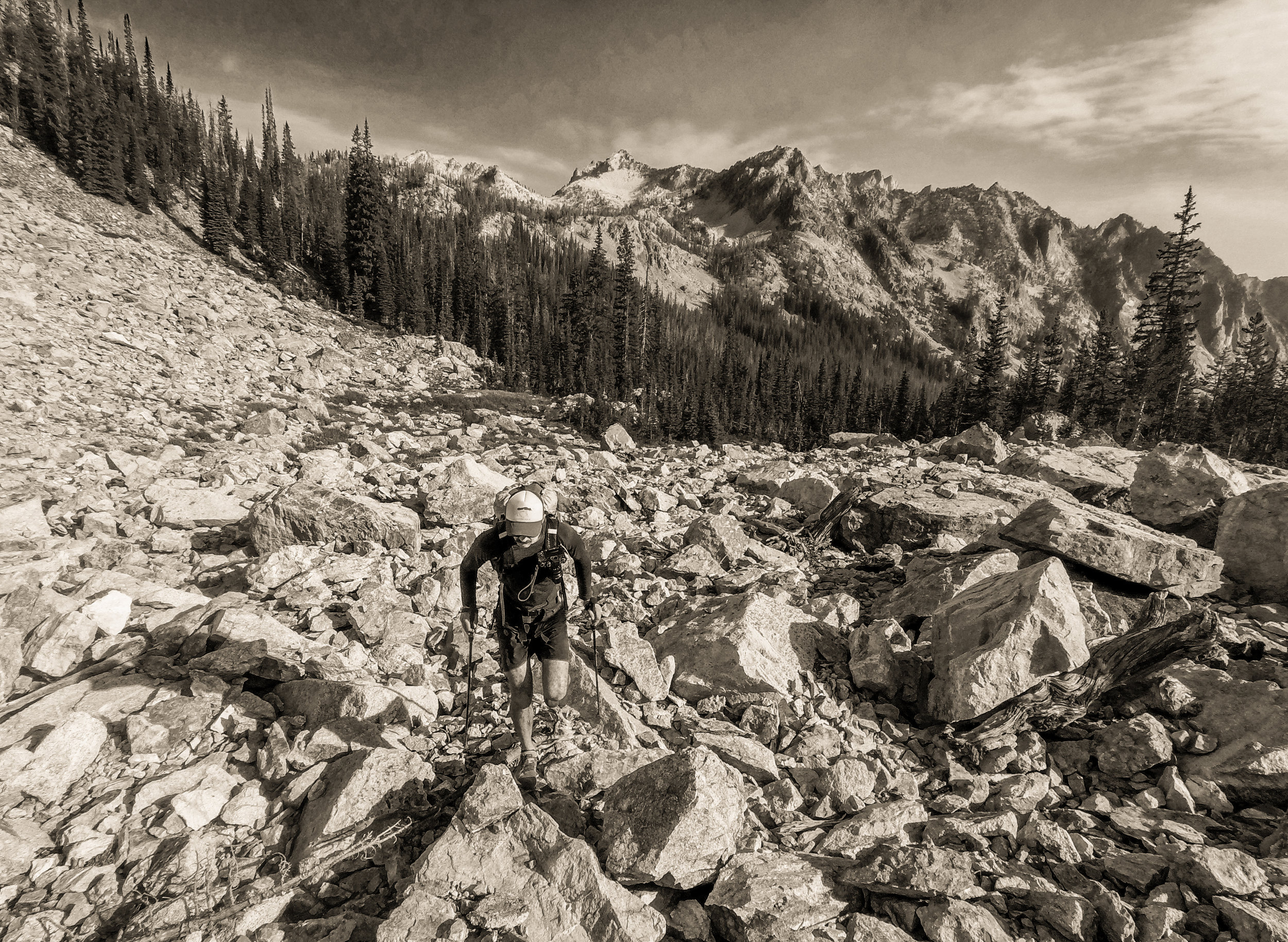
photo elliot hohn
Designing a route like this has been a dream of mine since I first followed Andrew Skurka’s beta breadcrumbs to complete California’s epic Sierra High Route. The little notes amidst the topo lines spoke volumes about the author’s familiarity with terrain and movement. I wanted that! I dreamt of picking a range, designing a route based on the topo and heading out to explore it on foot. Making camp and recording the days notes as a meditation on the experience.
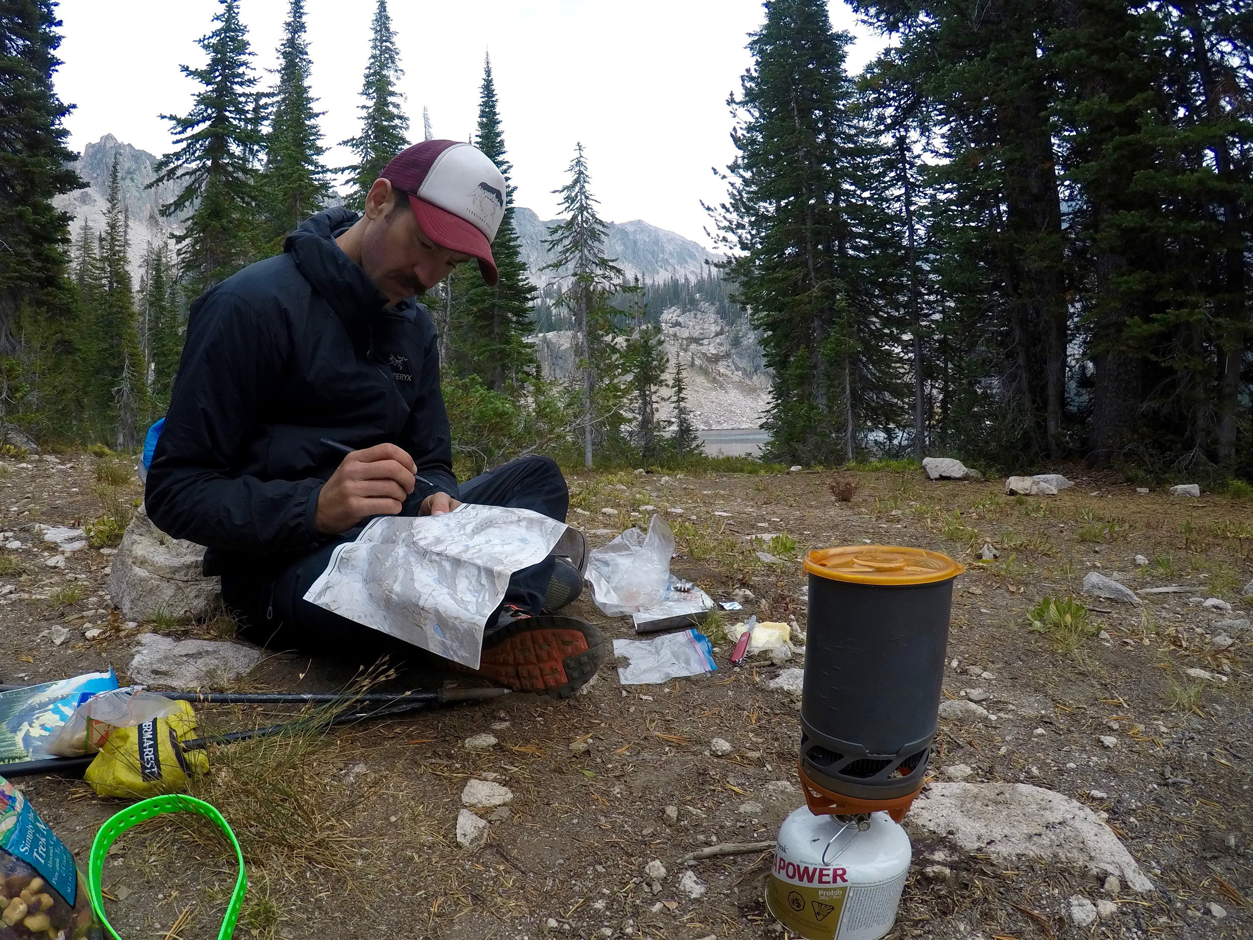
photo elliot hohn
Elliot and I met at a ski mountaineering race on Mt Hood last spring, and his athleticism and unassuming manner immediately appealed to me. Backcountry talent with none of the bullshit braggadocio so prevalent in mountain sports. Add his good taste in music, adaptability, and calm demeanor under pressure and and you’ve got all the aspects one seeks in a mountain partner.

When Elliot and I first chatted about exploring the Sawtooths, it struck me as the perfect chance to practice pioneering a high-route. In the last five years my van tires have cut a deep groove in I84 on the Portland-Salt Lake City-Denver line, but outside that narrow band my Idaho experience is limited. Rumors of this rugged and lightly visited range have swirled and collected in my mind over the years, so when a week of high pressure was forecast for mid-September we seized the opportunity.
As the trip drew near the planning began in earnest. With a bit of a process and faith that the adventures I plan will manifest, I now relish what was once a dreaded step. The answers to a few simple questions set the wheels in motion.
What experience do I want?
Can I find a partner, or do I want to do this alone?
Am I willing to commit the time?
Can I defend the risks involved?
What would a successful trip look like, is there a reasonable chance of it?
Once I’ve wrapped my head around these questions, the execution’s fun. I pull up maps on Caltopo, eye slope angles, spot passes between drainages, consider escape options. Once I have a good idea of the route, I pdf the maps and send them to Precision Images, a local print shop who’ll convert them to waterproof hardcopy for a song. Maps in hand in two hours? Hell yeah, we’re in business now.

The Sawtooths break into view as the sun sets, nine hours of podcasts, coffee, and baked goods from Portland. We roll south on Route 75, paralleling our planned track. Out West lies the ragged ridge we’ll soon follow on foot.

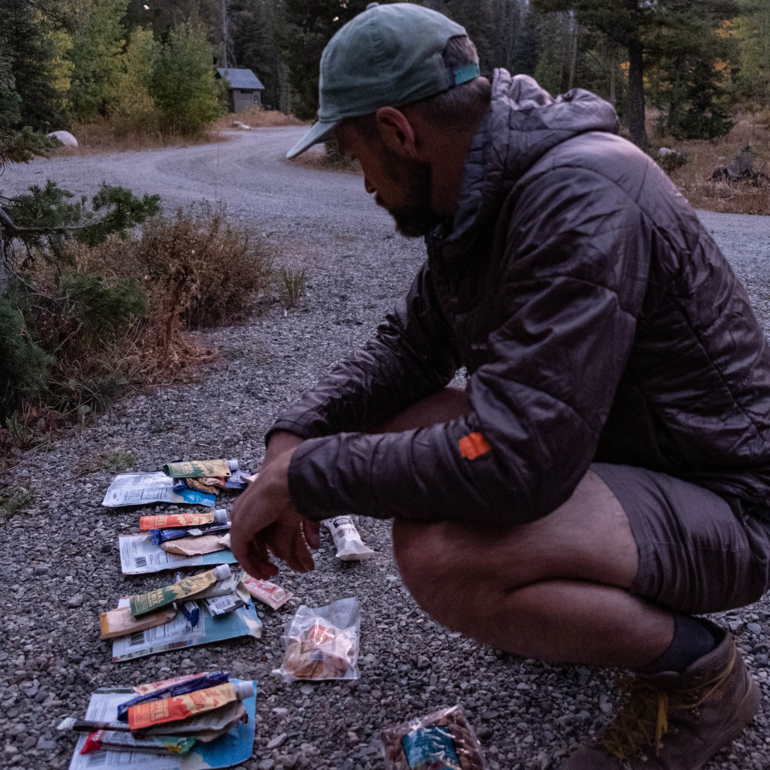
At the trailhead we make final preparations, aligning provision with ambition. We’re looking to pack light to allow for efficient and enjoyable movement. Cuisine is mostly simple and freeze-dried, but we’re not about to leave the sausage, cheese, or whiskey behind.
Adventure is full of uncertainty, that’s the point. From our hitchhike north on the first morning of the trip, to looking up at a steep headwall of snow and ice at the end of a box canyon, the benefit of trips like this is that they put us face to face to face with our fear and force us to act in the face of it.
Once we work our way into the high country, we establish the simple, difficult rhythm that will come to characterize the trip.

We wake each morning to a tent full of cold air and hazy light. Pull water from a nearby lake or stream. Make coffee, breakfast, pack up, and we’re soon afoot and moving through the brightening day.
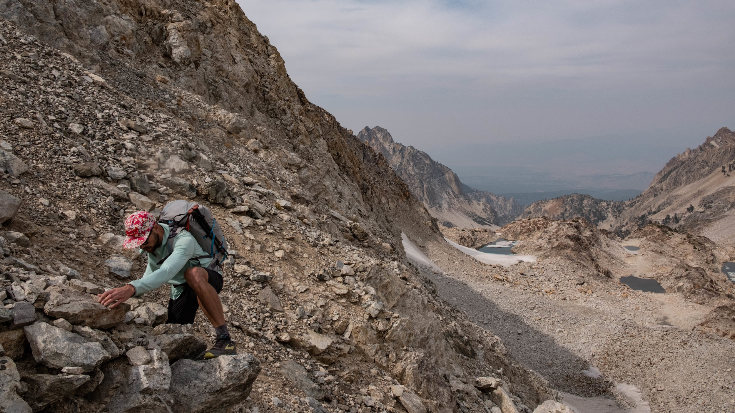
The landscape unfolds in a series of vast glacial valleys separated by the range’s namesake rugged spines. Each day a new challenge awaits. Stacked cliffbands with no obvious descent route, sprawling boulderfields with shifting blocks the size of refrigerators. Some basins offer up easy travel, others contain unpredictable scree that leave us with bruised shins and bashed ankles. Carefully picking our route to target weaknesses in the granite walls that surround us, we’re able to keep the difficulty to 3rd class or lower.

For navigation we eschew gps and stick to our paper maps and compass, a straightforward affair since we’re above treeline much of the time and it’s easy to pick out landmarks. Whenever we crest a ridge, new terrain sprawls out in front of us. Fall is coming and cold wind blasts us full in the face on these exposed vantages. Maps flap wildly in the wind as we orient ourselves before retreating to the leeward side of ridges to compare notes. we plot our path using the handrail of swirling topo lines and our assessment of the terrain before us.

photo elliot hohn
When afternoon comes around we start looking for places to camp. We find an alpine lake or a high perch. Something with a water source and broad view of sky. A flat piece of ground. We pitch the tarp tent and watch the shades of blue darken, the alpenglow lighting the spines around us and the stars emerging.

The simple rhythm of the trail means movement, food, water, shelter, and navigation fill the short fall days. The long evenings allow time to chat, write, and look ahead to the next day’s travel.

“I shine my headlamp over to where the goats are tied up and count five pairs of eyes, we’ve only got four goats. I take a closer look and there’s a cougar crouched and ready to pounce, he’s ten feet away and those things can jump 20”

We’re traversing a lake-dotted shelf we spot the pack-goats picking their way gingerly around the water’s edge.
“They don’t like the water” Larry says, walking up to us, well ahead of his charges. “C’mon now!” he shouts.
We greet him. He’s been goat-packing these mountains for years and we ask him about the predator tracks. We’ve seen them pressed into the mud of every lake we’ve passed, telling a story we’re not able to decipher. He leans on a trekking pole and holds forth.
“They bring these Canadian wolves down here, you look at a map of the Idaho packs and the circles all run together. You’ve gotta be careful packing in these hills with wolfbate like these” he casts a glance towards his goats, munching happily on the scrub at the lakeshore. He continues his cougar story. “I holler at my buddy, he brings his pistol over. Now I don’t like killing anything but this cougar’s not giving me options so I yell at him to shoot it! His pistol goes off and that cat exits stage left, we never found it. I was up the rest of the night worried he’d come back.”
We say our farewells to Larry and the goats and move on to our final night in the mountains. We’re five miles from the car now but it feels much further as we make camp on a granite spit thrusting into the depths of another alpine lake. We celebrate our last night out by sipping the last of our whiskey and the first flakes of winter snow spit from the sky.

In hindsight it’s easy to see trips like this as a foregone conclusion. It’s worth remembering that this trip could easily not have happened. We now have an experience we’ll remember for years because Elliot and I set aside the time, committed to an adventure together, and launched. One afternoon in early summer we had the conversation that set the wheels in motion.
“So what week works for you?” The midsummer sun bakes the concrete of Director park in downtown Portland. Fountain Water splashes beside us and birds swoop to eat picnic scraps. We looked at each other over a calendar sprawled on the bench between us.
“how about the second week of September?” Elliot said.
“yeah, that looks good, let’s do it.”

photo elliot hohn